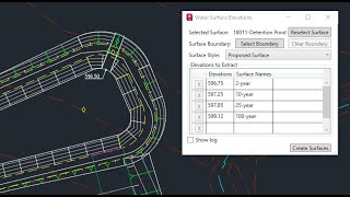
Water Surfaces
年
作業系統:
語言:
說明
Extract precise elevations from an Autodesk® Civil 3D® surface and create multiple surfaces with predefined names and a style.
Optionally, select a polyline or pick points to define an outer boundary of the new surfaces.
Apply a single style to all new surfaces created through this command.
Use these surfaces for downstream project tasks such as sectioning and profiling through ponds and channels.